Solar Energy LocalSolar Energy Local
Solar Energy & Solar Power Resources

Solar Energy in Burns, KS

Solar Energy in Burns

The month of August has the highest historical solar radition values in Burns with an average of 6.34 kWh/m2/day. [More]

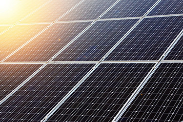
Solar Panels in Burns

Solar panels in Burns that are tilted towards the equator at an angle equal to the latitude will produce the maximum solar energy output. [More]

Sunrise & Sunset in Burns

The total length of the day in Burns, KS today (April 24, 2024) will be 13 hours and 36 minutes. [More]

Compare Solar Quotes
Burns, KS Solar Energy

Solar Power in Burns, KS

Solar Energy Data in Burns, KS

See the chart below to see how different types of solar panel installations compare in Burns.

* Amounts listed in kWh/m2/day (kilowatt hours per square meter per day).
* See glossary & definitions below.


Solar Energy Analysis for Burns, KS

Solar Radiation Data in Burns

Based on historical Burns, KS data, solar panels that are tilted towards the equator at an angle equal to the latitude will produce the maximum solar energy output in Burns. [1]

Burns has an average monthly Global Horizontal Irradiance (GHI) of 4.5 kilowatt hours per square meter per day (kWh/m2/day), which is approximately 11% less than the average monthly Direct Normal Irradiance (DNI) of 5.04 kWh/m2/day. [1]

Solar installations in Burns that are always titled at the latitude of Burns (Average Tilt at Latitude or ATaL) average 5.27 kWh/m2/day, or about 17% greater than the average monthly GHI of 4.5 kWh/m2/day and approximately 5% greater than the average monthly DNI of 5.04 kWh/m2/day. [1]

Solar Energy Glossary

Global Horizontal Irradiance (GHI)

Global Horizontal Irradiance: The total amount of solar radiation that is received per unit area by a surface that is always positioned in a horizontal manner.

Direct Normal Irradiance (DNI)

Direct Normal Irradiance: The total amount of solar radiation received per unit area by a surface that is always perpendicular to the sun rays that come in a straight line from the direction of the sun at its current position in the sky.

Average Tilt at Latitude (ATaL)

Average Tilt at Latitude: The total amount of solar radiation received per unit area by a surface that is tilted toward the equator at an angle equal to the current latitude. ATaL will often produce the optimum energy output.

Solar Radiation Levels in Burns

Solar Radiation Data in Burns, KS

See the chart below for monthly solar radiation levels in Burns.

* Amounts listed in kWh/m2/day (kilowatt hours per square meter per day)

Solar Radiation Analysis for Burns, KS

Solar Radiation Data in Burns

Burns, KS has a average annual solar radiation value of 5.49 kilowatt hours per square meter per day (kWh/m2/day). [1]

The month with the highest historical solar radition values in Burns is August with an average of 6.34 kWh/m2/day, followed by July at 6.27 kWh/m2/day and September at 6.23 kWh/m2/day. [1]

The three months that historically average the lowest average solar radiation levels in Burns (Kansas) are December with an average of 4.07 kWh/m2/day, followed by January with an average of 4.53 kWh/m2/day and November at 4.76 kWh/m2/day. [1]

Compare Solar Quotes

Solar Power Comparison: Burns vs. the U.S.

Solar Power Levels in Burns

The average monthly solar radiation level in Burns, KS, of 5.49 kilowatt hours per square meter per day (kWh/m2/day) is approximately 40% greater than the average level of 3.93 kWh/m2/day in a city with historically low levels (WA) and is approximately 17% less than the average level of 6.61 kWh/m2/day in a city with historically high levels (NV). [1]


→ Values listed as 0 (zero) are not available (N/A).

Solar Power: Burns vs. the U.S.

Below is a month-by-month comparison of how average Burns solar radiation levels compare to average levels in a city with historcially high levels (NV) and a city with historically low levels (WA). [1]

→ k/m/d = kWh/m2/day = kilowatt hours per square meter per day.
→ Values listed as 0 (zero) are not available (N/A).

Solar Data & Statistics for Burns

Sunrise / Sunset in Burns

  • Sunrise/Sunset for April 24, 2024 [2]
    • Sunrise: 6:37 am
    • Sunset: 8:13 pm
    • Length of Day: 13:36
Solar Energy Statistics for Burns

Best Months for Solar in Burns

  • Top Solar Power Months Historically [1]
    • Solar Radiation August (6.34 kWh/m2/day)
    • ATaL: July (6.19 kWh/m2/day)
    • DNI: July (6.43 kWh/m2/day)
    • GHI: July (6.73 kWh/m2/day)

* See glossary & definitions above.

Solar Panel Installs in Burns

We do not currently have data on solar panel installations in the city of Burns, KS at this current time.

Solar Power Output in Burns

The Power of Solar in Burns, KS

Monthly AC solar system output averages for Burns (ks). Month-by-month solar power, as ranked by AC output, in Burns. [2]

* Amounts listed in kWhac (kilowatt hours (AC))

Solar Output Analysis for Burns, KS

Solar Radiation Data in Burns

Burns (KS) has a average annual solar AC output value of 6220.55 kilowatt hours (AC). [2]

The month with the highest historical solar power output in Burns is July with an average of 580.86 kWhac, followed by August at 569.38 kWhac and September at 564.9 kWhac. [2]

The three months that historically average the lowest average solar output levels in Burns (Kansas) are December with an average of 414.8 kWhac, followed by February with an average of 447.08 kWhac and November at 455.33 kWhac. [2]

Cost of Utilities in Burns

Burns Electricity Costs

Sorry, Burns residential electricity prices are currently unavailable.

Please check back later.

Solar Power Poll: Burns

Vote now: Given all of the data and analysis provided for Burns, is solar power a good choice for residents of this city?

Yes, solar power is a great option  
No, solar power isn't a good option

Burns Natural Gas Costs

Sorry, Kansas residential natural gas prices are currently unavailable.

Please check back later.

Weather Forecast for Burns, KS [5]

Wed Apr 24
69°F
Light Rain
Min: 51°F
Max: 71°F
Gentle Breeze: 12 mps SE
Precip.: Chance of Rain
Humidity: 33%
Cloud cover: 74%
Thu Apr 25
61°F
Moderate Rain
Min: 56°F
Max: 69°F
Strong breeze: 26 mps S
Precip.: Chance of Rain
Humidity: 97%
Cloud cover: 100%
Fri Apr 26
78°F
Light Rain
Min: 65°F
Max: 80°F
Strong breeze: 28 mps S
Precip.: Chance of Rain
Humidity: 34%
Cloud cover: 48%
Sat Apr 27
82°F
Heavy Intensity Rain
Min: 64°F
Max: 83°F
Strong breeze: 30 mps S
Precip.: Chance of Rain
Humidity: 44%
Cloud cover: 24%
Sun Apr 28
70°F
Light Rain
Min: 49°F
Max: 70°F
Fresh Breeze: 21 mps W
Precip.: Chance of Rain
Humidity: 52%
Cloud cover: 0%
Mon Apr 29
62°F
Sky Is Clear
Min: 42°F
Max: 68°F
Moderate breeze: 16 mps NW
Precip.: n/a
Humidity: 50%
Cloud cover: 1%

More about Burns

About Burns

The city of Burns, KS in Marion County has an approximate population of 228. [6]

Burns Solar Power

Burns, KS Solar Energy

To learn more about solar energy and solar power Burns, KS, or for more solar-related resources for Burns, visit the U.S. Energy Information Administration.

Did you know?

It takes light about 8 minutes, 19 seconds to travel the 93,000,000 miles from the sun's surface to us on Earth.

Other Cities in Kansas

ZIP Codes in KS


Go

References

[ X ]

Is solar right for your home?

Take the first step toward powering your home with solar energy.

Start now with an online solar savings estimate.